Rain is on the way and lots of it, according to Environment Canada.
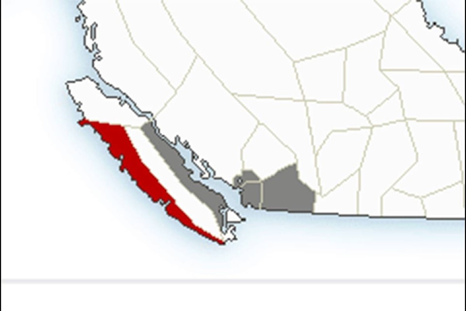
Environment Canada issued a special weather statement on Monday for the east coast of Vancouver Island, including the Cowichan Valley, Nanaimo, Parksville and more, while they issued a more serious weather warning for west Vancouver Island due to an intense weather system that is approaching the region from the central coast of B.C.
Environment Canada meteorologist Armel Castellan said the Island’s west coast can expect to see as much as 100 to 150 mm of rain to fall between Monday afternoon and Tuesday morning.
He said communities north of Fanny Bay on the eastern side of Vancouver Island and the Lower Mainland will likely see between 50 and 75 mm of rain in the same time period, while southern sections, including the Cowichan Valley, are forecast to receive between 15 and 20 millimetres of rain.
“We’re forecasting three weather systems to hit the Cowichan Valley back-to-back during the week, with the one on Monday night and Tuesday to be the first,” Castellan said.
“Short on the heels of the first system is another that will see the dreariness continue, but not with heavy rain, and the final one is forecast to begin Wednesday and continue through Thursday in which the Valley will receive a heavy swath of wind. We should have up to 30 millimetres of rain in the Valley by that time, and up to four more on Thursday.”
Authorities are reminding drivers that heavy rains can cause flash flooding and water pooling on roads.
Castellan said temperatures are also expected to drop well below normal by the weekend, but the skies are forecast to be clear.
He said temperatures will likely drop below freezing at night, beginning on Friday, with daytime temperatures averaging between 5 C and 7 C.
“The freezing levels are currently at about 3,500 feet, but it will come down to about 1,000 feet during the upcoming cold spell, and that means that any precipitation at this level could be in the form of snow,” Castellan said.
“That could include the Malahat, but that level may still be too low for snow right now.”
robert.barron@cowichanvalleycitizen.com
Like us on Facebook and follow us on Twitter