With about 35,000 people hiking and biking the trails on Maple Mountain annually, and a whopping 80,000 visiting Mount Tzouhalem’s trails every year, North Cowichan is looking to bring some order to their chaotic trail systems.
Much of the land where the trails exist on the two mountains is located within North Cowichan’s municipal forest reserve, and the municipality has been working with Cowichan Tribes, the Cowichan Trail Stewardship Society, and other landowners and stakeholders to designate official trails and create trail markers and maps to make accessing and using the trails easier.
Don Stewart, North Cowichan’s deputy director of parks and recreation, said many existing trails have been created with no approval from the landowners for years, with no organization or proper planning, and the municipality hopes to change that practice.
“People have been hiking and biking anywhere they wanted, and we’ve decided that the trail systems have to make some sense,” Stewart said.
“Staying on designated trails is important for many reasons; including preventing trespass onto adjacent private land, protecting important First Nations cultural sites, stewarding ecologically sensitive areas and reducing habitat fragmentation.”
RELATED STORY: NORTH COWICHAN GETS $500K FOR NEW MULTI-USE TRAIL
Stewart said North Cowichan will begin with Maple Mountain and Mount Tzouhalem this summer, followed by work on the trail systems on Mount Richards and Mount Prevost over time.
He said much work has already been completed on Maple Mountain, and work on Mount Tzouhalem’s trail systems will launch in August.
Stewart said test trail sign posts were installed on Maple Mountain in June with permanent signage expected in August, a test kiosk with trail maps and other information is being installed at the main entrance to the mountain off Osborne Bay Road this month, along with plans to eventually place kiosks at all the major entrances to the trails systems.
The trail maps will also include which users can have access to each trail, including bikers, hikers and horse riders.
Stewart said a geo-referenced downloadable map is also available of the designated trails at www.northcowichan.ca/trails.
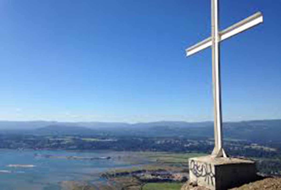
As for Mount Tzouhalem, Stewart said the plan is to reduce the total number of trails, rename some of them to make the trail system easier to understand by users, the installation of trail signage, including to the mountain’s most popular destination, “The Cross”, and trail maps will be placed at key trailhead locations.
“It’s important that we take all the many trails on Mount Tzouhalem down to a number we can manage,” he said.
“We want to curb the use of the trails that are not designated and let them die off naturally. We believe that most users will be respectful and stay on the designated trails that have good signage.”
Stewart said, like Maple Mountain, maps of the designated trail system for Mount Tzouhalem will also be available online when the they are completed, expected in August.
Ernie Mansueti, the municipality’s director of parks, forestry and recreation, said the number one request by residents over the years is more and better trail systems in North Cowichan.
“Just 10 years ago, we had signs up everywhere to keep people out of our municipal forest reserve, but a lot has changed and there has been a big turnaround since then,” he said.
“Our intent is to bring some order to the trails systems. People who are not experts on trail building have been doing it for years on those lands, and it has been having ecological and other impacts.”
robert.barron@cowichanvalleycitizen.com
Like us on Facebook and follow us on Twitter