Torrential rain over a short amount of time over the weekend and into Monday left parts of the Cowichan Valley, including roads, highways, businesses and homes, flooded and crews North Cowichan’s four fire halls going non-stop.
An atmospheric river caused the weather event, which in parts of the region, dumped close to 180mm of rain on Cowichan according to Chris Carss, a Chemainus weather observer who records data on a volunteer basis for Environment Canada.
As for the atmospheric river that caused this weather event, “this seems to be a new term for the good old jet stream, that upper level wind circulation that determines the storm track at any given time,” Carss explained. “In this case, the jet stream was coming from the southwest, i.e. Hawaii, so we had a particularly wet version of the familiar Pineapple Express, no doubt intensified by – you guessed it – global warming.”
Rainfall totals overall for November could be record-setting with several days still left in the month.
North Cowichan manager of fire and bylaw Martin Drakeley was at a loss for words when it came to explaining the emergency response efforts of the crews of North Cowichan’s four halls: Chemainus, Crofton, South End and Maple Bay.
“They did an amazing job,” he said. “I don’t know what to say.”
All told, the four crews responded to 22 calls on the day for public service (flood related rescues/assistance), car accidents, structure fire calls that ended up being short circuits of the electricity due to the flood, and alarms that were also short circuiting.
“It was a busy day,” Drakeley said.
The first call came in at 6:20 a.m. and the firefighters didn’t rest until long after their last call at 10:30 p.m. And that was only North Cowichan’s halls. The CVRD’s fire departments across the region, as well as Cowichan Valley Search and Rescue, the RCMP, the BC Conservation Officer’s Service, the CVRD’s emergency reception centre staff, and more a were also very busy all day.
“They were just going from one call to the next,” Drakeley explained. “It seems like a long span of time but these calls were not easy. There were people to be rescued from homes. We only have two boats in the municipality so we had to wait until rescuers were done. We were hampered by the highway and Pinson’s Corner being cut off by water. They had to use the trucks to try and wade through the water. They adapted quite quickly through the situation,” Drakeley said.
Early in the day, he noted, a lot of people initially refused to leave, for their own reasons.
“We had to go back a couple hours later to rescue them because they were in need of rescue,” he said. Drakeley hopes next time people understand that when first responders show up, it’s serious.
“When we come it’s not because we want to have fun. It’s because it’s an emergency situation,” he said.
Drakeley said Pinson’s Corner, and the Mount Sicker Road area were hit the worst, from what he saw, along with Allenby Road, where there was flooding and a serious landslide near the overflowing Cowichan River.
The ordeal has reminded Drakeley about how important preparedness really is in this day and age.
“You don’t want to admit that this is going to be a regular thing; It didn’t happen last year but it did the year before,” he said.
“We just need to be prepared a little bit more for it. Having a boat on the other side of Pinson’s Corner and Mount Sicker would be beneficial but it’s not just the boat cost but the safety gear and training that go along with it,” he explained.
“It turns out to be quite an ordeal and in times of budget constraint getting into additional equipment and training, it has to be well thought out. It’s not like we haven’t thought it though.”
Out west, Lake Cowichan was not immune to the significant rainfall. The Town’s Chief Administrative Officer Joe Fernandez reported workers had to set up bypasses on some roads where water blocked some areas, making driving difficult.
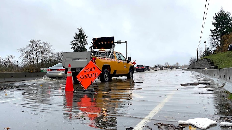
Emergency officials along Highway 18 responded to a vehicle crash as well as a mudslide that jutted out onto the road a short distance from Skutz Falls.
More streets than could be tallied were affected by or closed outright by water.
In the central and east parts of the region, as is typical for storm season, Cowichan Bay Road and parts of Tzouhalem Road were closed, as was Canada Avenue closer to Duncan.
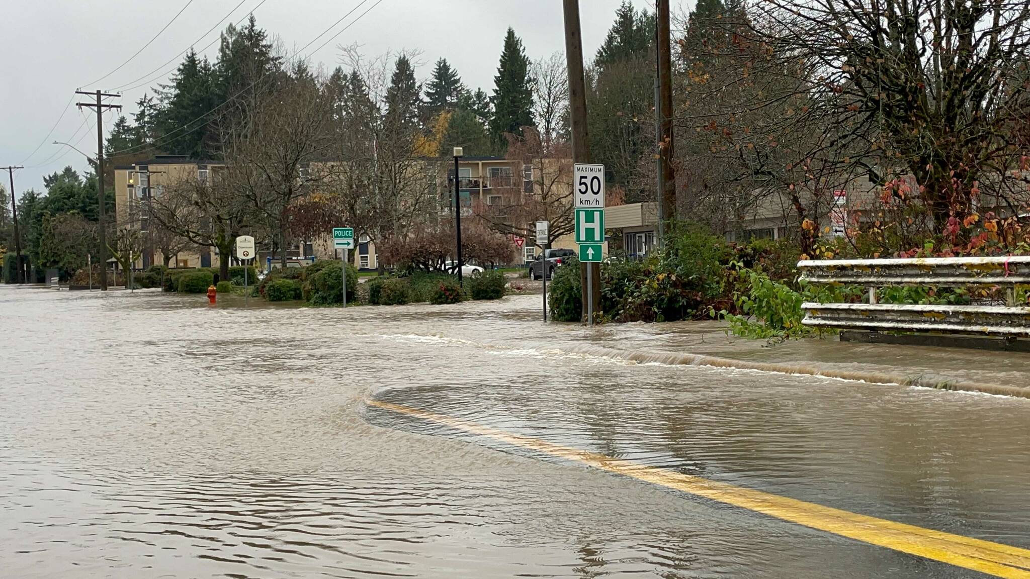
The water rose so high, the RCMP had to move their cruisers to dry ground and the Meadow Glen Apartment building was evacuated for a time.
In the north end, water spilled over the highway in the Mount Sicker area and elsewhere headed toward Nanaimo, while in the south, many other areas between Duncan and Victoria flooded — prompting the shutdown of the Malahat Drive on the Island Highway as well.
Parts of Shawnigan Lake were cut off and other areas within the regional district, particularly within Halalt and Cowichan Tribes lands, also saw high, often fast flowing water as the rivers breached their banks.
Travellers are still advised to check conditions before they go as many road closures are still in effect throughout the region and beyond.
The CVRD’s state of local emergency was still in place by press time on Wednesday afternoon.